Cadcorp SIS Desktop
- Cadcorp SIS Desktop supports Web Map Tile Services (WMTS).
- Cadcorp SIS Desktop supports Web Map Services (WMS).
- Cadcorp SIS Desktop supports Web Feature Services (WFS).
WMTS
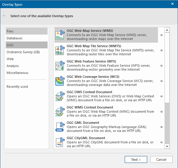
- From the Home Tab select the Add Overlay option.
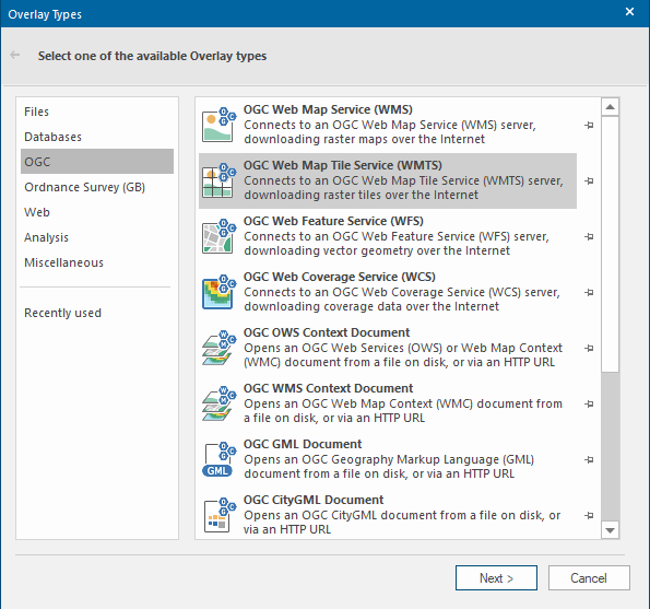
- Select OGC from the list on the left and then the OGC Web Map Tile Service (WMTS) option. Click Next.
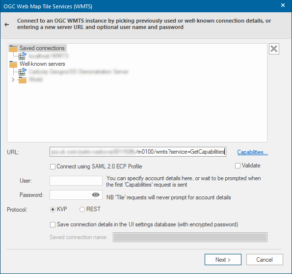
- Copy your relevant URL into the URL box (and if using Basic Authentication, insert your Username and Password). See the documentation on viaEuropa WMTS to find the appropriate service end point. At this point check the WMTS Protocol you are using, either KVP or REST (both are supported). Click Next.
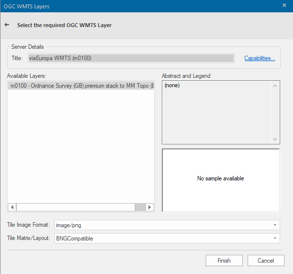
- Select the relevant layers that you want to add, along with ensuring that the Tile Image Format and Tile Matrix Layout are correct. Click Finish.
WMS
- From the Home Tab select the Add Overlay option.
- Select OGC from the list on the left and then the OGC Web Map Service (WMS) option. Click Next.
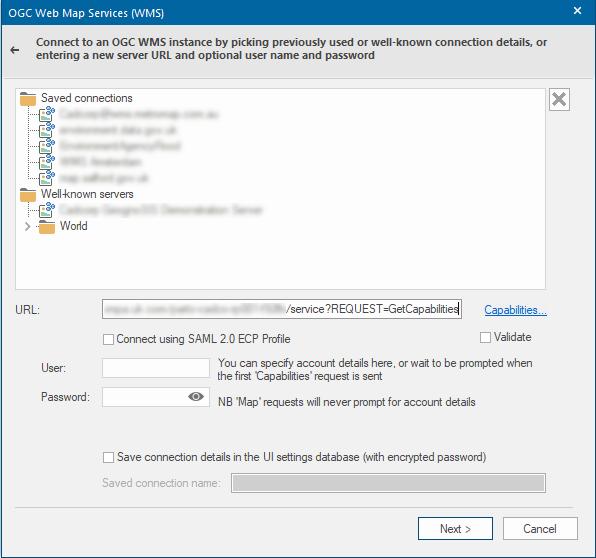
- Copy your relevant URL into the URL box (and if using Basic Authentication, insert your Username and Password). See the documentation on viaEuropa WMS to find the appropriate service end point. Click Next.
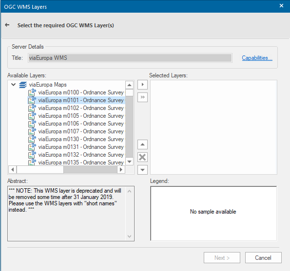
- Select the relevant layers that you want to add. Click Next.
- Ensure that the projection is correct and that the image format is correct. Click Finish.
WFS
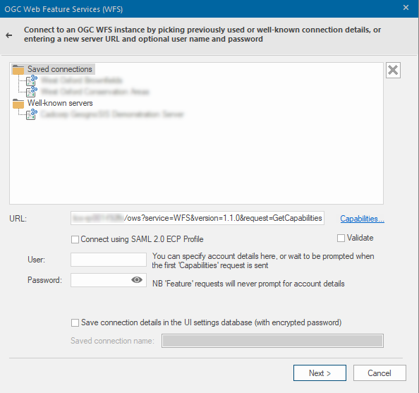
- From the Home Tab select the Add Overlay option.
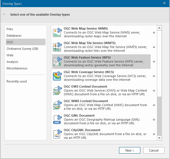
- Select OGC from the list on the left and then the OGC Web Feature Service (WFS) option. Click Next.
- Copy your relevant URL into the URL box (and if using Basic Authentication, insert your Username and Password). See the documentation on viaEuropa WFS to find the appropriate service end point. Click Next.
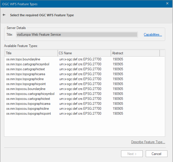
- Select the relevant layers that you want to add. Click Next.
- Select the attributes that you want to bring along with the geometry. Click Next.
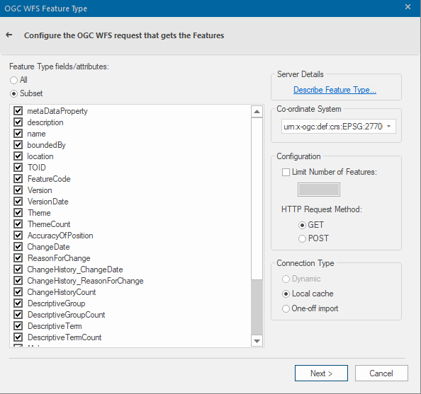
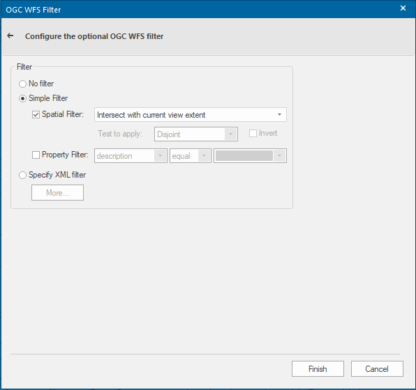
- Set any optional OGC WFS Filter that you require. For most use cases it is recommended that a Spatial Filter is used to retrieve only the features that intersect with the current view extent. Click Finish.